


Mema Multi Branch Locator Map
Mema Multi Branch Locator Map lets site administrators manage map locations without editing plugin code. Add as many marker locations as your site needs, provide translated names and addresses, and display them in an interactive map. It is an independent plugin and is not affiliated with OpenStreetMap or Google.
Map providers:
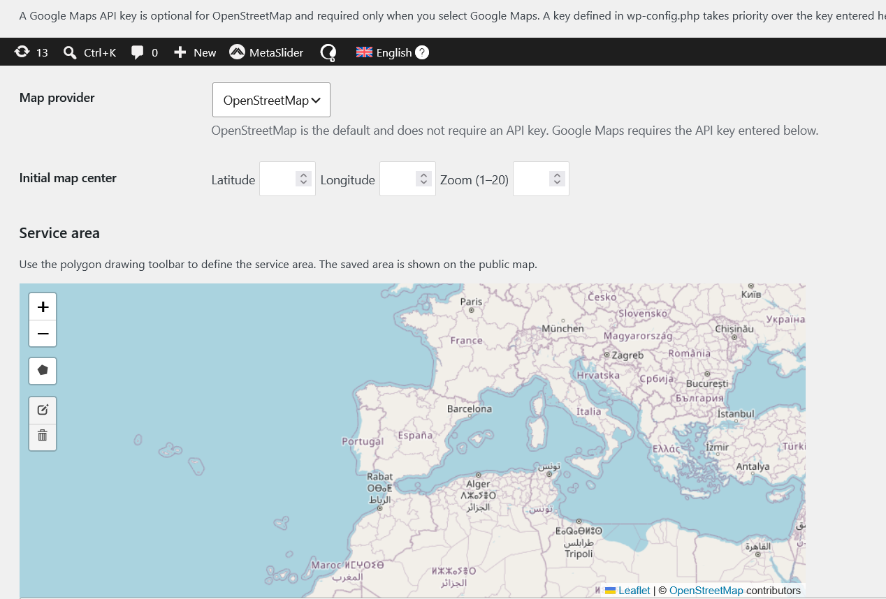
- OpenStreetMap is the default and does not require an API key. Enter latitude and longitude for each location.
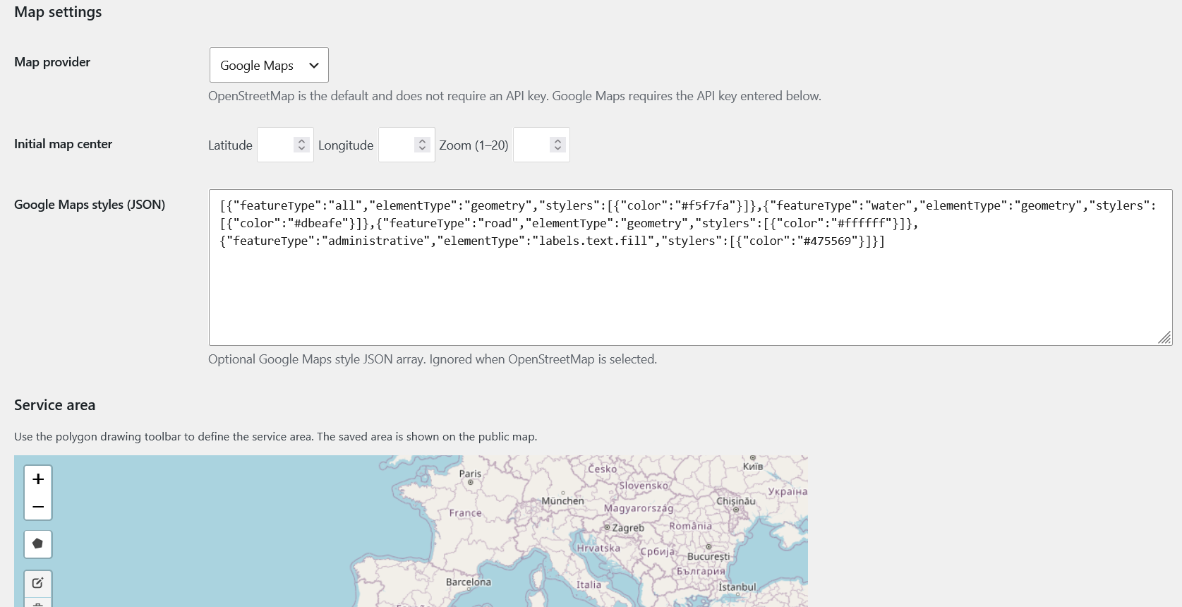
- Google Maps can geocode a location from its address when coordinates are not provided. A Google Maps API key with the required Maps JavaScript API and Geocoding API enabled is required.
Features:
- Add, edit, and remove as many marker locations as needed in WordPress Admin. Actual throughput is subject to the selected provider’s usage limits and quotas.
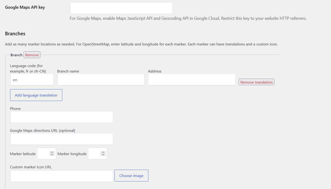
- Add translations with language codes such as
en,fr,ar, orzh-CN. - Choose a map provider globally or override it per shortcode.
- Configure the initial map center and zoom globally or per shortcode.
- Apply custom JSON styles to Google Maps.
- Choose a custom marker image from the WordPress Media Library.
- Draw, edit, and save a polygon service area; display it with either provider.
- Let visitors request their current location and add a temporary marker (with their permission).
- Display each marker’s title, address, optional phone, and directions link.
- Provide map reset and marker visibility controls.
- Embed maps on pages, posts, and custom post types with
[branch_locator]. - Use WordPress translation functions for the plugin interface and translated marker content for any configured language.
Locations and map configuration are stored in WordPress options. No business locations are bundled with the plugin.
Usage
Basic shortcode:
[branch_locator]
Optional shortcode attributes:
lang— marker translation to display. Accepts a language code such asfrorzh-CN. Defaults to the current WordPress locale.provider—osmorgoogle. Defaults to the provider selected in plugin settings.zoom— initial zoom level from 1 to 20. When omitted, the map fits the saved markers when possible.center_latandcenter_lng— initial map center. Both must be provided.height— map height in pixels, for example600pxor600.
Example:
[branch_locator lang="fr" provider="osm" zoom="12" center_lat="48.8566" center_lng="2.3522" height="600px"]
The shortcode can be added to standard posts and pages, or to the content of a custom post type that supports shortcodes. The plugin does not automatically create or inject maps into every custom post type.
For OpenStreetMap, the coordinates entered for a marker determine its position. For Google Maps, coordinates are preferred when present; otherwise, the address from the selected translation is geocoded. If a requested translation is not available, the plugin uses that branch’s base-language translation or its first available translation.
The service-area drawing tool creates a polygon. It does not calculate delivery eligibility or restrict markers and map interactions.
Map providers and third-party services
The plugin uses the following external services when the corresponding map provider or feature is used. These services receive requests directly from the site visitor’s browser (or, for the service-area editor, the administrator’s browser).
OpenStreetMap tile service
OpenStreetMap tiles are loaded to display the map whenever an OpenStreetMap map is displayed. The service receives the browser’s IP address, requested tile URLs (which disclose the map areas viewed, including the area around a visitor’s location if they use the location control), and normal request headers such as the referrer. The service-area editor also requests tiles from the administrator’s browser when the settings page is opened. Map tiles are provided by the OpenStreetMap Foundation’s community service and are subject to its usage policy; the service is not guaranteed for high-volume use.
Google Maps Platform
When Google Maps is selected and a map shortcode is displayed, the plugin loads the Google Maps JavaScript API from Google and includes the configured API key in that request. Google receives the visitor’s IP address, site referrer, map/API request data, and normal browser request headers. If a branch has no saved coordinates, its configured address is sent to Google’s Geocoding service to place the marker. If a visitor chooses the location control, their coordinates are passed to Google Maps to center the map and place the temporary marker. If a visitor clicks the directions link, they are sent to Google Maps with the branch destination in the URL. Google Maps use is governed by Google’s terms and privacy policy.
The plugin’s service-area editor uses the locally bundled Leaflet and Leaflet Draw libraries; it does not contact an additional library CDN.
Privacy
When a visitor opens a map, the selected map provider and its tile or API services receive requests from the visitor’s browser as described above. The Google Maps API key is sent to Google only when Google Maps is selected and its map is displayed. OpenStreetMap tiles are used for the service-area editor on the settings page.
The Use my location control requests the visitor’s location only after they choose the control. The browser may ask for permission. If granted, the coordinates are used to center the map and place a temporary marker. When Google Maps is selected, the coordinates are sent to Google Maps as part of those map interactions; with OpenStreetMap, the tile requests disclose the approximate area being viewed. This plugin does not send or save the visitor’s location to WordPress.
Branch names, addresses, phone numbers, marker coordinates, icon URLs, and map settings entered by an administrator are stored in the site’s WordPress options table.
Details

Related plugins
Plugins that also contain the tag branch-locator
LocatorLTE – Premium Store Locator


About
Plugin for that tries to help you find the WordPress plugin you are looking for.
| Please enjoy an image of Crush (this awesome turtle) and have a lovely day! |  |
We do not own any plugin listed on this site and do not work for or work with WordPress.com or it's associated companies. We simply provide a searchable list of the available WordPress plugins.