



Sleekode Interactive Maps
Sleekode Interactive Maps is a powerful WordPress plugin powered by Leaflet and OpenStreetMap.
Create location directories, tourist guides, store maps, event maps and community maps directly from the WordPress admin area.
Display responsive interactive maps anywhere using a simple shortcode.
Perfect for:
- Tourist guides
- Facility maps
- Office locations
- Event maps
- Community maps
- Store maps
- Campus maps
Key Features:
- Powered by OpenStreetMap (no Google Maps API required)
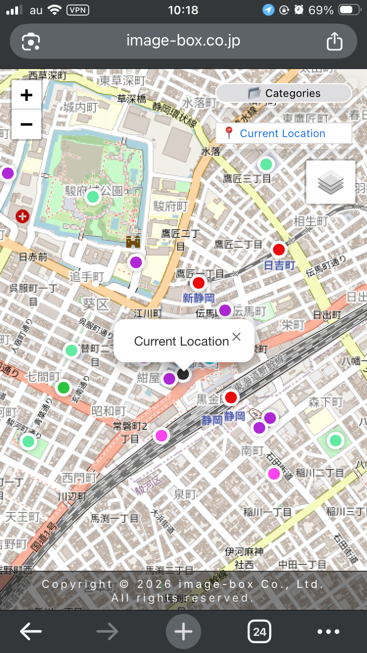
- Current location detection
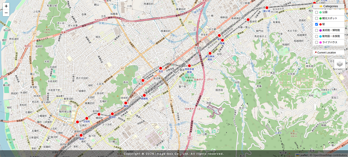
- Category-based marker filtering
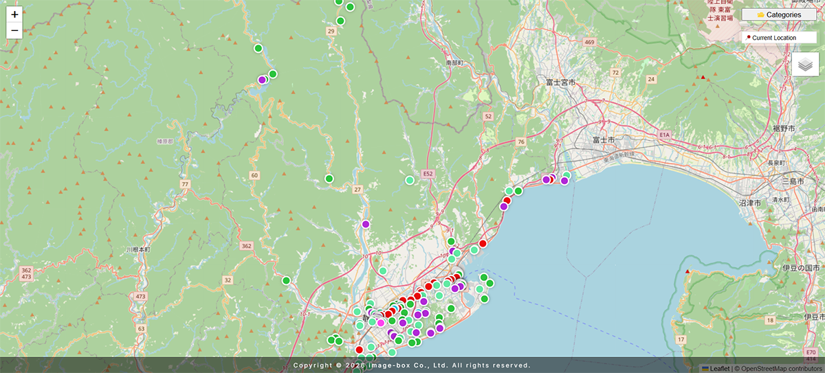
- Marker clustering for large datasets
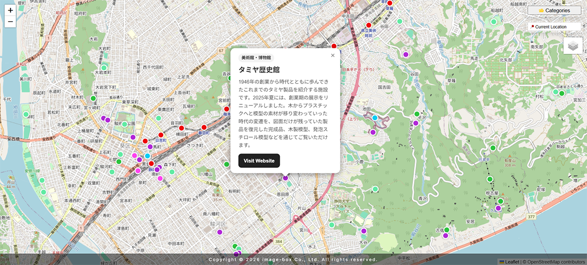
- Responsive popup cards
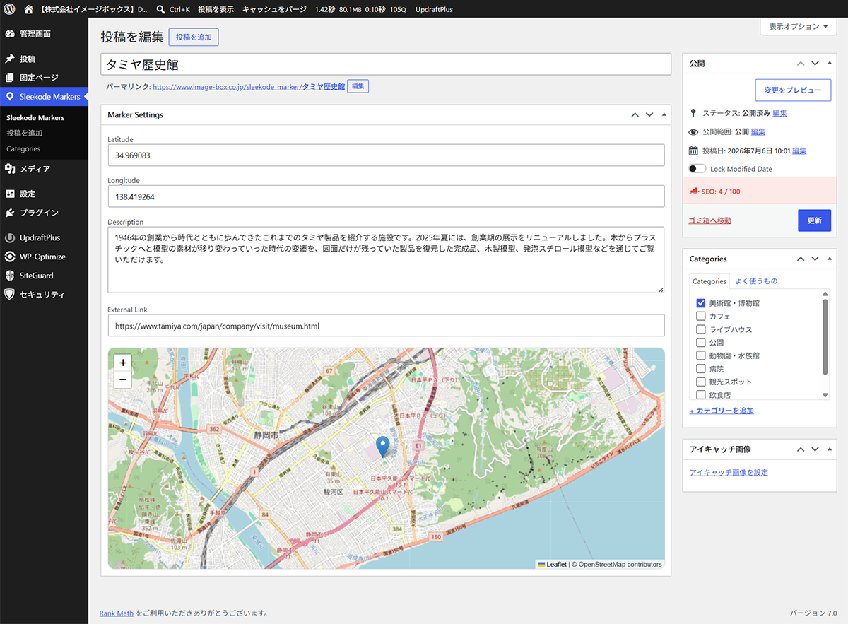
- Drag-and-drop marker editing
- Multiple map layers
- Flexible shortcode options
- WordPress native content management
- JSON export and import
- CSV import support
- CSV template download
- Bulk delete utility
- Category color management
- Translation ready
Live Demo:
https://www.image-box.co.jp/digital-map.html
Features
Interactive Maps
Display interactive maps powered by Leaflet.js and OpenStreetMap. Fast, lightweight and fully responsive.
Marker Management
Manage locations using a dedicated custom post type. Easily create, edit and organize markers directly from the WordPress dashboard.
Drag & Drop Position Editor
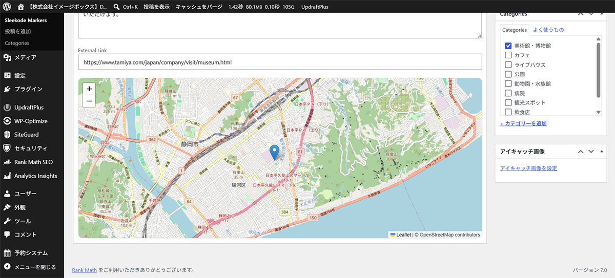
Adjust marker positions visually using the built-in map editor. Latitude and longitude values are automatically synchronized.
Category Filters
Organize markers using WordPress taxonomies and allow visitors to filter locations dynamically on the map.
Current Location Detection
Allow users to jump directly to their current location with a single click.
Marker Clustering
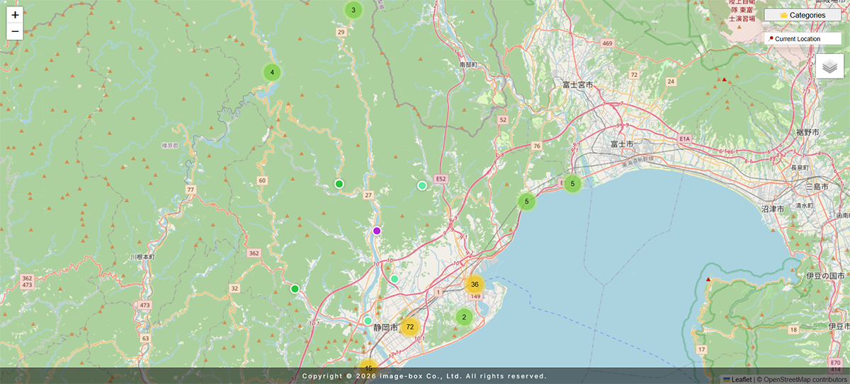
Automatically group nearby markers to improve performance and usability when displaying large numbers of locations.
Rich Popups
Display featured images, descriptions, categories and external links inside responsive popup cards.
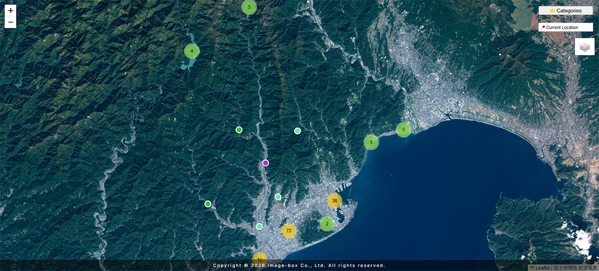
Multiple Map Layers
Switch between:
- OpenStreetMap
- GSI Maps (Japan)
- Satellite imagery
Import & Export
Export all markers and categories as JSON.
Import JSON backups with duplicate detection.
Import CSV files for bulk marker registration.
Download a CSV template from the settings page.
Images stored in the WordPress Media Library are not included in import/export files and must be migrated separately.
Flexible Shortcodes
Control map behavior directly from shortcode parameters.
Examples:
[sleekode_map]
[sleekode_map category=”station”]
[sleekode_map height=”600″]
[sleekode_map cluster=”false”]
[sleekode_map zoom=”10″]
[sleekode_map lat=”35.681236″ lng=”139.767125″]
[sleekode_map tiles=”satellite”]
[sleekode_map tiles=”gsi”]
License
This plugin is licensed under the GPLv2 or later.
Third-Party Libraries
This plugin includes:
Leaflet
Copyright (c) Vladimir Agafonkin
License: BSD-2-Clause
https://leafletjs.com/
Leaflet.markercluster
Copyright (c) Leaflet contributors
License: MIT
https://github.com/Leaflet/Leaflet.markercluster
Details
Related plugins
Plugins that also contain the tag geolocation
SlimStat Analytics

Price Based on Country for WooCommerce

Geolocation IP Detection

IP Location Block

HivePress Geolocation

Country Based Restrictions for WooCommerce


About
Plugin for that tries to help you find the WordPress plugin you are looking for.
| Please enjoy an image of Crush (this awesome turtle) and have a lovely day! |  |
We do not own any plugin listed on this site and do not work for or work with WordPress.com or it's associated companies. We simply provide a searchable list of the available WordPress plugins.